Black Cutworm

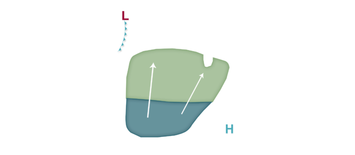

The weather pattern is already transitioning to a more active zonal or southwesterly flow as a low pressure system develops in the northern Rockies/High Plains and high pressure currently in the Ohio River valley shifts into the southeastern United States. A rather broad area of south to southwesterly winds, at times gusty in nature, will be rather persistent especially south of a slowly moving cold front. Low migration risks accompany these southerly winds mainly in areas along/south of I-90 for the next few nights. By late week, forecast uncertainty with respect to positioning of a developing warm front and also a lack of more focused southerly winds in areas that would be most at risk for any black cutworm damage (notably north of I-90) precludes a risk at this time. Growers with newly emerged and in early vegetative growth stages should be scouting fields at this time. Look for holes in leaves and/or plants that have been entirely broken off and make any treatment decision based on threshold values for your area and in specific fields.
