Corn Earworm
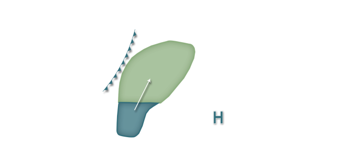
A couple of cold fronts in continued largely northwest dominated flow will pass through the corn-growing region in the next week. With the rather progressive nature of northwest flow as well as an unfavorable source region predicted for any southerly wind events, the overall corn earworm risk remains in the Low category in the next five days. A cold front will begin to advance through the Plains and upper Midwest later today and tonight and may pose a Low migration risk especially in fields west of Lake Michigan in Wisconsin and further southwest into Kansas, Nebraska, southeast South Dakota, southern Minnesota, Iowa, northwest Missouri, and far northwest Illinois. As the cold front progresses rather quickly southeast on Tuesday, the risk area shifts east into the lower Great Lakes region and eastern Midwest as well as the Mississippi River valley south of I-80. The source region during this time is predicted to focus across west Texas into Oklahoma so any migrating populations should be rather minimal so only isolated flights are predicted. A Low risk is back in the forecast for Thursday and Friday nights mainly across the western corn-growing region as the next low pressure system moves in and southerly winds increase. Growers all across the corn-growing region are encouraged to monitor their fields for larvae as earlier moth flights this growing season may and likely are causing problems in some fields despite the lack of new flights in the past few weeks. Additionally, moth populations are beginning to build across some portions of the southern United States, so the primary second generation flight may occur with favorable weather in the next few weeks especially as host plants in the south move past attractive stages to corn earworm.


