Corn Earworm

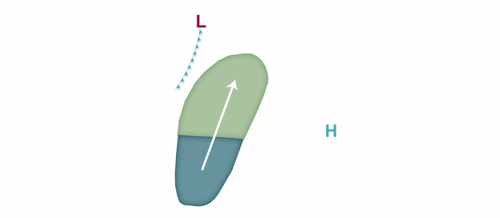

Corn earworm migration risks will be on the increase as we head into late week and the weekend as a couple of cold fronts drop southeast into the corn-growing region. The weekend front looks the strongest, and migration risks have been increased as a result of increased confidence in the timing and strength of the second front along with crop stage both in the source region and further north in the corn-growing region. Low risks are in place tonight into tomorrow morning mainly west of the Mississippi River and as far north as South Dakota, Minnesota, and Wisconsin as south to southwest winds aloft may lead to some isolated moth flights ahead of a weakening cold front. Precipitation along this front may serve as an insect drop zone for any migrating insects. Low risks then follow in the forecast for tomorrow night into Friday morning mainly south of I-90 and along/just east of the Mississippi River, or from Kansas and Missouri north into Nebraska and Iowa as well as far southwest portions of Wisconsin and western Illinois. By the weekend, the second and stronger of the two cold fronts is expected to begin impacting the corn-growing region, and Moderate risks are in place from eastern Nebraska into southeast South Dakota, southern Minnesota, Iowa, and southwest Wisconsin Saturday night into Sunday and then across northeast Missouri into eastern Iowa, Illinois, southern Wisconsin, southwest lower Michigan, and northern/central Indiana Sunday night into Monday morning with Low risks extending as far east as southern Ontario, Canada and Ohio by that time. Growers with crops at susceptible stages, both field crops and specialty/fresh-market growers, should monitor traps and prepare to begin scouting as this weekend’s system could result in the first respectable flight of corn earworm moths this summer.
